|
|
软件介绍:
cn5ihksiszs.png

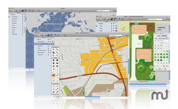
Ortelius是一个全功能的载体是绘制地图设计中的应用。Ortelius允许你绘制直接用如道路,河流,海岸线,建筑特征,符号和轮廓。Ortelius是以其独特的“连接轨道”和专家叠加样式,绘制地图功能简单乏味的。每个对象支持的属性的数据可以被引用的文本标签,都可以直接绘制和简单的拖放的位置。虽然Ortelius不是一个地理信息系统,它有导入shapefile最小支持度(开发商注意地理和更多…
Ortelius is a full-featured vector drawing application especially for map design. Ortelius allows you to draw directly with features such as roads, rivers, coastlines, buildings, symbols and contours. Ortelius is known for its unique “connectable tracks” and expert stacked styles that make drawing tedious map features easy. Every object supports attribute data that can be referenced by text labels, and everything can be directly drawn and positioned simply by dragging and dropping. Though Ortelius is emphatically not a GIS, it does have minimal support for importing shapefiles (developers note georeferencing and more…
软件截屏:
iaovugfrnyh.jpg

系统要求:
OS X 10.7 or Later
VIP 下载(百度云、360云盘):
链接: http://pan.baidu.com/s/1dFsQCZv 密码: p1m9 |
|